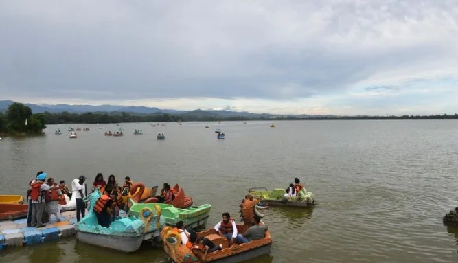
CHANDIGARH, Oct. 18 — With Sukhna Lake’s water-holding capacity shrinking by nearly half over seven decades, the Chandigarh Administration is turning to advanced sound wave technology to assess the extent of siltation and plan its long-term restoration. For the first time, bathymetric profiling—a globally used sonar-based mapping technique—will be deployed to measure the lake’s depth, sediment levels and dredging feasibility.
According to the Administration’s newly drafted Integrated Sukhna Management Plan, the lake’s storage capacity has fallen from 1,074 hectare metres in 1958 to just 545 hectare metres in 2015, a reduction of almost 50%. Officials said the lake’s capacity temporarily improved by about 27% in 2002 after its height was raised by two feet, but continued siltation and evaporation have since reversed those gains.
The Forest and Wildlife Department, in collaboration with the World Wide Fund for Nature (WWF)—a Swiss-based international NGO—has prepared a five-year rejuvenation plan for the lake, which remains central to Chandigarh’s ecology, groundwater recharge and tourism.
Officials said the upcoming bathymetric survey will employ echo sounders that emit sonar waves into the lake. The time taken for the waves to bounce back from the bed will be used to calculate the depth and silt thickness with high precision. The readings will then be paired with GPS data to create a 3D digital model of the lakebed.
“Areas showing excessive silt accumulation will be shortlisted for wet dredging, allowing desilting without draining the lake,” said an official associated with the project. “In sections where dredging is not feasible, the Administration may consider raising the lake’s height again to boost its capacity.”
To complement sonar data, Lidar (Light Detection and Ranging) technology may also be used. Lidar employs laser pulses to measure underwater contours, helping create a more accurate bathymetric map.
Experts said the scientific assessment will help determine whether deeper, permanently submerged areas can be safely desilted. Until now, desilting has been limited to shallow, dried-out zones during summer months. But since the lake has not completely dried in recent years, sediment build-up has steadily worsened.
Officials described the new initiative as a “shift from periodic, ad-hoc desilting to a data-driven, long-term conservation strategy.” The survey results, they said, will form the foundation for future interventions, from dredging and structural measures to catchment-area management.
Sukhna Lake and its surrounding catchment have already been notified as a wetland, and the UT Administration has sent a proposal to the Centre seeking its inclusion in the Ramsar list of internationally significant wetlands.
The upcoming survey, officials added, is expected to provide the most detailed scientific understanding of Sukhna’s current state since its creation in 1958—laying the groundwork for restoring the lake’s capacity, ecological balance and iconic charm.

