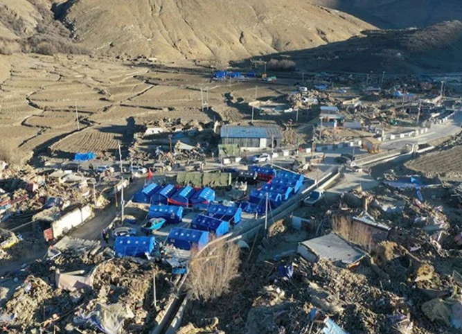
TIBET — July 30: Tibet was jolted by a second earthquake on Wednesday, hours after an earlier tremor struck the seismically active region, the National Center for Seismology (NCS) confirmed.
The latest quake, measuring 4.0 on the Richter scale, occurred at 11:31 a.m. IST at a shallow depth of 10 km, which increases the potential for aftershocks and surface-level damage.
In a post on X, NCS said: “EQ of M: 4.0, On: 30/07/2025 11:31:02 IST, Lat: 28.32 N, Long: 87.65 E, Depth: 10 Km, Location: Tibet.”
Earlier in the day, a 4.3-magnitude quake had rattled the same area at 6:58 a.m., also at a depth of 10 km. Both tremors occurred in close proximity, signaling heightened tectonic unrest.
Shallow quakes like these are known to produce stronger ground shaking, making them more hazardous. “Because seismic waves have less distance to travel to the surface, shallow earthquakes often result in greater damage and risk,” experts said.
The Tibetan Plateau sits on a major fault line where the Indian tectonic plate collides with the Eurasian plate—an ongoing geological process responsible for regular seismic activity and the elevation of Himalayan peaks.
Meanwhile, heavy rainfall in Tibet early Wednesday intensified flooding in rivers that flow into Nepal. Authorities in Nepal have issued flood alerts in at least three districts, including Rasuwa, which borders the quake-hit region.
The Trishuli River saw a sharp rise in water levels, particularly near Uttar Gaya and the Trishuli 3B Hub in Kispang. Rasuwagadhi, a key border town, is also on high alert as water continues to swell.
On July 8, a flash flood from the Lhende River in Rasuwa district claimed seven lives, with more than a dozen still missing. That event was also linked to heavy rainfall on the Tibetan side.
Disaster response teams in both countries are closely monitoring the situation as seismic and weather-related threats converge.

