
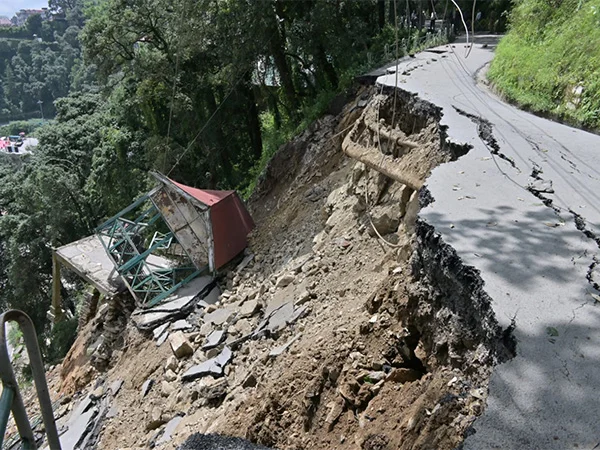
Shimla, August 26: A joint geological evaluation of the Chandigarh-Shimla highway segment between Solan and Shimla has identified serious structural risks, with over half the evaluated route showing moderate to extreme landslide vulnerability. The scientific assessment provides detailed mapping of 48 active landslide sites along the 45-kilometer stretch of the key mountain highway.
Detailing the scientific findings, researchers declared that unscientific slope modifications and infrastructure expansion have disrupted the natural balance of the Himalayan terrain. Experts affirmed that road widening projects involve toe removal and unexamined slope cutting, asserting that human interference hastens terrain collapse during heavy precipitation events. Researchers maintained that immature topography combined with steep slopes creates severe hazards for thousands of daily commuters and freight vehicles traveling to the state capital.
The spatial analysis reveals that 34.8 percent of the area falls within high to very high susceptibility categories, while 26.58 percent exhibits moderate risk. The study area lies in a high-seismic zone, compounding the potential for major landslips triggered by either heavy monsoon rains or seismic events.
Addressing global data, the study noted that approximately 3.1 lakh square kilometers of landslide-prone land in India is situated within the Himalayan belt. Authors stated that extensive land modification and infrastructure development continue to elevate risk levels across sensitive mountain corridors, calling for geo-scientifically sound engineering practices during highway maintenance and development.
